
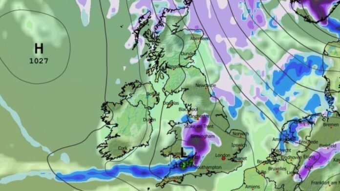

The UK is expected to experience cold spells and wintry showers towards the end of April, according to the latest forecast from the Met Office. Weather maps now indicate that up to 38 cities could see snowfall in the coming days.
The GFS weather model predicts snowfall across the UK starting on April 28, initially in northern Scotland before moving south towards London. Heavy snow is forecast for the north-east of Scotland, with lighter flurries expected in southern Scotland, the Pennines, and parts of Northern Ireland. Meanwhile, rain is anticipated in North Wales and along the east coast of England.
By April 29, snow is projected to spread across northern England, Yorkshire, and Lincolnshire, with additional flurries in Scotland and Northern Ireland. A subsequent snow band is forecast to move in from the west, bringing heavy snow to western England, including Manchester and Birmingham, and extending as far south as Bristol by April 30.
Although snowfall is expected to reach London on the morning of April 30, it is likely to be less intense than in western areas earlier in the day. Throughout this period, scattered snow showers are anticipated in various regions of the UK, affecting a total of 38 cities.
The Met Office warns of wintry showers impacting parts of the UK later this month, with a brief cold spell expected. The forecast for April 22 to May 1 suggests mostly dry weather, with occasional exceptions such as rain in the southwest due to Atlantic frontal zones. Towards the end of April, cold air may move southward, bringing wintry showers to the north and east, along with overnight frost, before giving way to milder conditions.